Vintage-Like Portage Canal
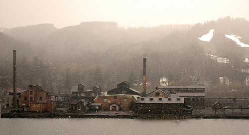
The Portage Canal is somewhere I’ve driven past hundreds of times in my life, but never have I seen it like this. This snow falling in the photo gives it a second effect of it being a grainy photo, adding that to the tone gives it a fantastic vintage look as if this photo was taken in the early 1900s. However, it was snapped just two weeks prior on May 3rd, 2008.
“Although beautiful, I couldn’t believe it was snowing at the beginning of May.”
A Brief History of the Portage Canal
- The only road across the Portage Canal is the Portage Lift Bridge
- Also known as the Keweenaw Waterway, Lily Pond, Portage River, and Portage Lake
- Connects Lake Superior at both North and South entries (see map below)
- The primary tributary to Portage Lake is the Sturgeon River
- Originally a small river, it was dredged in the 1960s for mining industry and allowing freighters in
- The area north of the Portage Canal is known as Copper Island
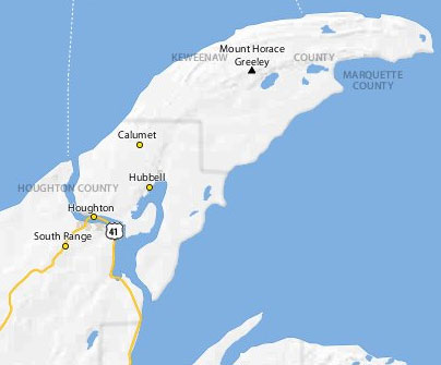
Photo courtesy of DailyInvention on Flickr.


