MODIS, Satellites, and the Frozen Great Lakes
Do you ever wonder where all these awesome satellite images of the frozen Great Lakes come from and where to access them?
With Lake Superior and the Great Lakes set to reach record levels of ice cover this winter, there has been an abundance of satellite images passed around on news and social media sites. However, there hasn’t been much information on where these impressive images came from. Our curiosity piqued and we set out to do a little research.
Satellite images of the Great Lakes are courtesy of the NASA instrument MODIS, which stands for Moderate-Resolution Imaging Spectroradiometer. Sounds fancy! The instrument is installed on two different satellites orbiting earth. It was installed on the Terra (from the Latin word meaning Earth) satellite that launched in 1999 and again on the Aqua satellite launched in 2002. These satellites are large components of EOS, the Earth Observation System from NASA. The program makes long-term global observations of the land surface, biosphere, atmosphere, and oceans of Earth.
Between both MODIS instruments they circle and make an image of the earth every 1 to 2 days, making images in a series of 36 spectral bands.
“These data will improve our understanding of global dynamics and processes occurring on the land, in the oceans, and in the lower atmosphere. MODIS is playing a vital role in the development of validated, global, interactive Earth system models able to predict global change accurately enough to assist policy makers in making sound decisions concerning the protection of our environment.” – NASA
Providing a view of the frozen Great Lakes is just one example of its use. Another specific advantage, relevant to the Upper Peninsula and heavily forested areas, is its role in detection of wildfires, data that is heavily used by the United States Forest Service.

As much as we love space facts, some of the technical specifications are just slightly over our head. Plenty of data, tech specs, and algorithms can be found on the MODIS website.
Data from MODIS can be accessed from a number of free online resource. Our favorite is from MODIS Today, provided by the Space Science and Engineering Center at the University of Wisconsin. Check out their site for daily updates across the Great Lakes region and United States.
Other sources of data include LAADS and ECHO Reverb.
Additionally, much of the data regarding the Great Lakes ice cover comes from the Great Lakes Enviornmental Research Laboratory (GLERL), a division of the National Oceanic and Atmospheric Administration (NOAA). The GLERL has been collecting data since 1974. In addition to ice cover you can also find handy maps regarding ice thickness, surface temperatures, water levels, cloud cover, and wave heights. And they do a lot more. Much of the data we read in the news regarding the Great Lakes is provided by the GLERL, as well as providing data and research to decision makers regarding out fresh water resources.
Great Lakes ice coverage as of March 5th, 2014
Great Lakes: 91.8%
Lake Superior: 95.1%
Lake Michigan: 92.5%
Lake Huron: 95.9%
Lake Erie: 95.7%
Lake Ontario: 49.4%
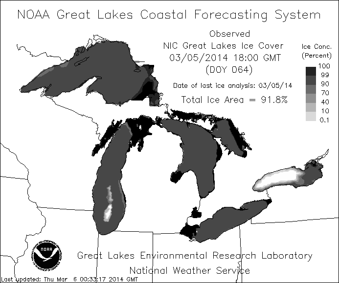
The NOAA Great Lakes Coastal Forecasting System shows the Great Lakes at 91.8% ice cover on March 5, 2014.
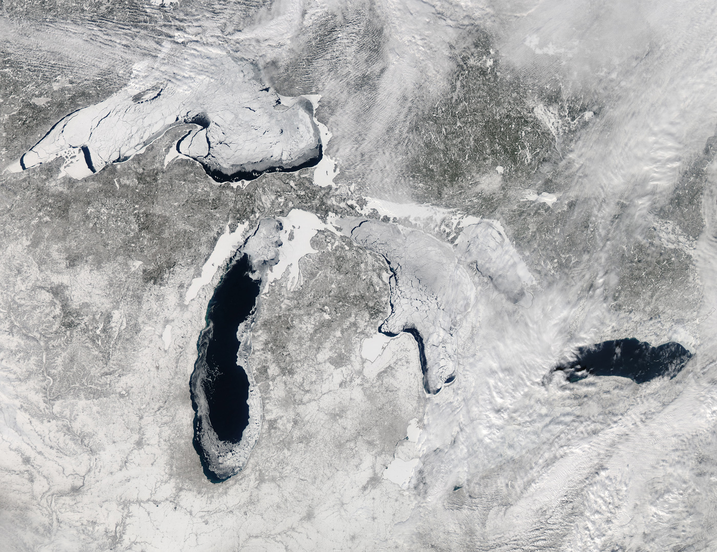
On a rare clear day you can see over 80% ice cover on the Great Lakes. MODIS satellite image from February 19, 2014.
A heavy amount of lake-effect snow over the Great Lakes. MODIS satellite image from January 25, 2014.


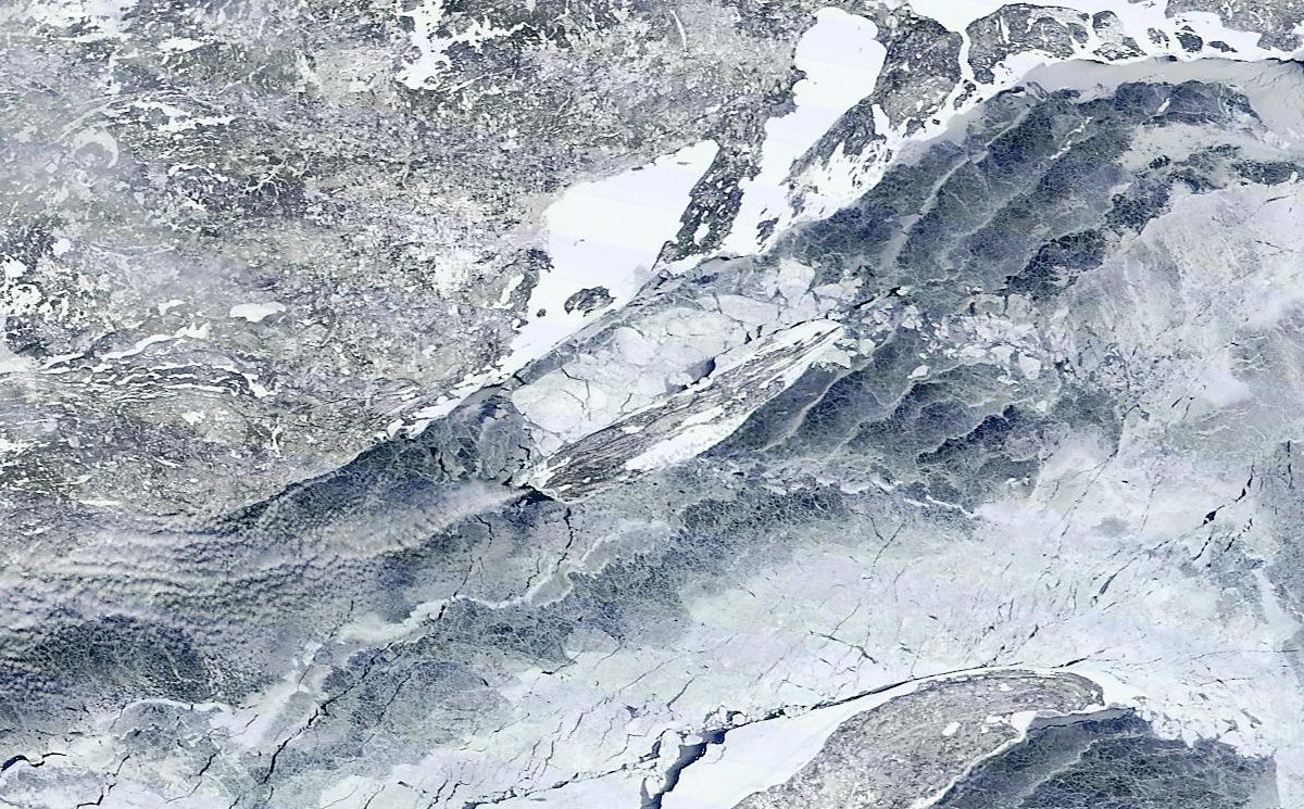
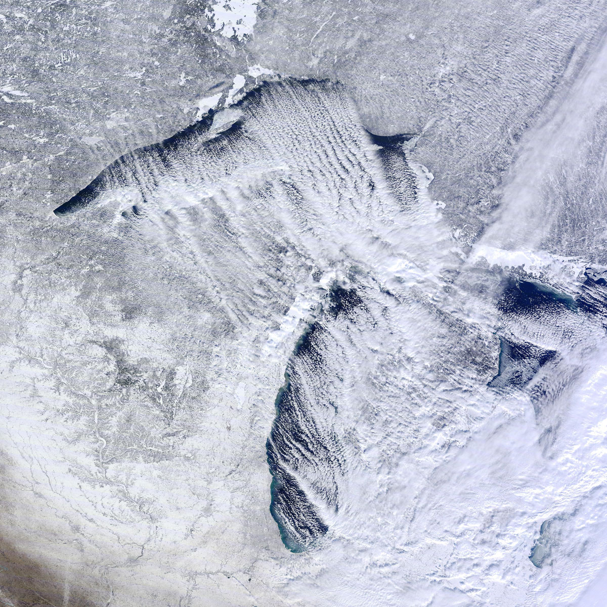
Ice cover on Lake Sueprior around Isle Royale. MODIS satellite image from March 05, 2014.

The details from MODIS are remarkable, including the ice break up around Ontonagon County and the Apostle Islands shown here. MODIS satellite image from March 05, 2014.
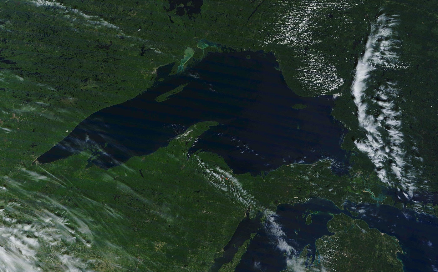
A clear day in the Upper Peninsula. MODIS satellite image from September 03, 2013.
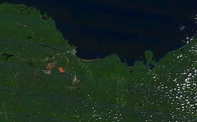
A detailed look of Marquette County from space. MODIS satellite image from September 05, 2013.
Fall colors as seen from space. MODIS satellite image from September 26, 2014.
Sources:
Great Lakes Environmental Research Laboratory
NASA & MODIS
Yale
Space Science and Engineering Center


